
The project "Gudenåstien - from source to fjord" is a three-year project to establish a coherent and uniformly marked hiking route with support facilities all the way from the source of the Gudenå River in Tinnet krat to its outlet in Randers Fjord. The trail will be 170 kilometers in total and runs through 8 municipalities and 3 units of the Danish Nature Agency. The path is already established in some places, so the project is to

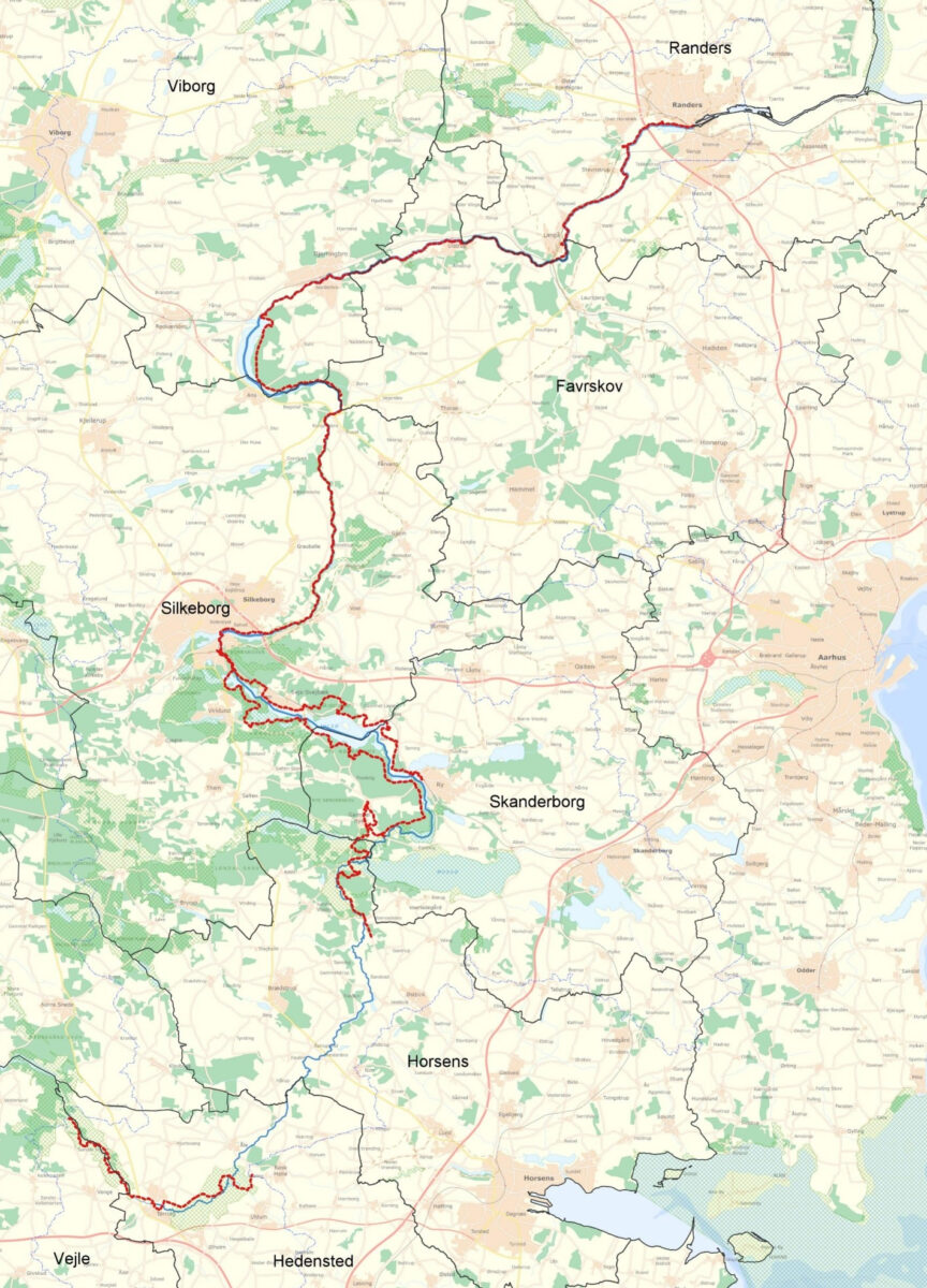
The Gudenå Trail will consist of already well-known hiking routes – primarily the Trækstien trail between Silkeborg and Randers and the Himmelbjergruten between Ry and Silkeborg. In addition, there is a stretch between Voervadsbro and Emborg bridge that is already named Gudenåstien. There is also a path between the spring and Uldum Kær, but it is not yet connected as one coherent route. North of Uldum Kær and as far as Vestbirk, there is currently no path – this will be established in the project. When the project is complete, you can walk along the Gudenåen trail from source to fjord. Trækstien and Himmelbjergruten will continue to be named as now, but will also be part of the Gudenå Trail.
See where you can walk the Gudenå Trail today
All project partners who make or have boards etc. made for the project "Gudenåstien - from source to fjord" are obliged to use the approved designs, pictograms, base maps etc. All files and instructions can be downloaded from Gudenåens Fællesdrev. Here you'll also find specifications for material selection, financial specifications and other project documents. To access Gudenåens Fællesdrev, download the team app and contact project manager Thomas Brandt Ebbesen who can give you access. Write to Thomas at tebb@favrskov.dk or call 21336940.