Hiking
  Sailing
  Fishing
  Cycling
  Visit attractions
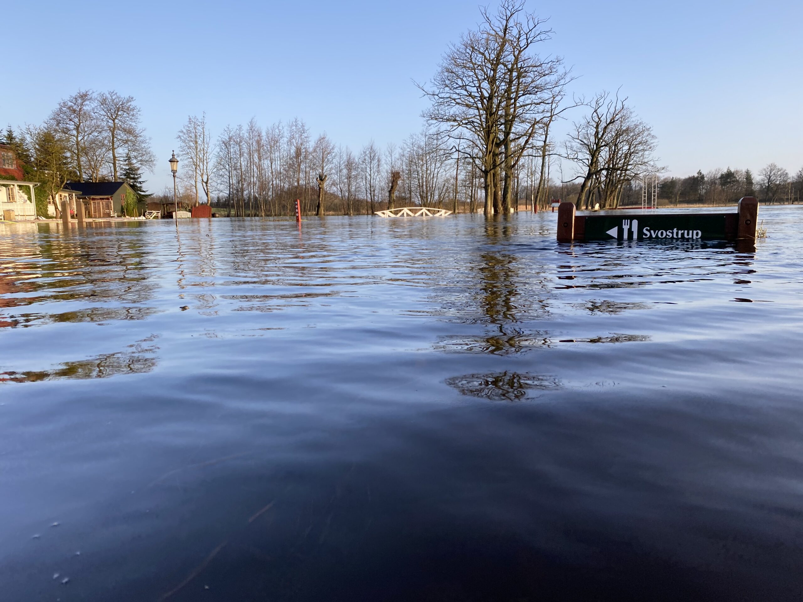
Is the Gudenå Trail passable?
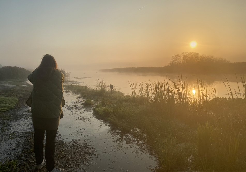
On the Gudenå Trail, you walk with the water by your side – and usually very close to the river. Therefore, it will be wet, and sometimes flooded, on certain stretches when the water level is high.
There are two ways to find out about the trail’s passability:
- You can go to the Gudenå map, click on “Hiking” and then on “Flooding on the Gudenå Trail”. Here you can see if the path is red, yellow or green. QR codes are placed on each side of the potentially flooded section in a place where you can choose the alternative route around it.
- Red: Take the alternative path shown
- Yellow: You can get through with rubber boots or a good pair of hiking boots
- Green: If the path is dry.
- Or you can check out the most vulnerable routes on this page – see below.
You can also ask in the Facebook group Farbargudenaa, where users help users with information about the navigability of the Gudenå Trail.
Routes that are often wet:
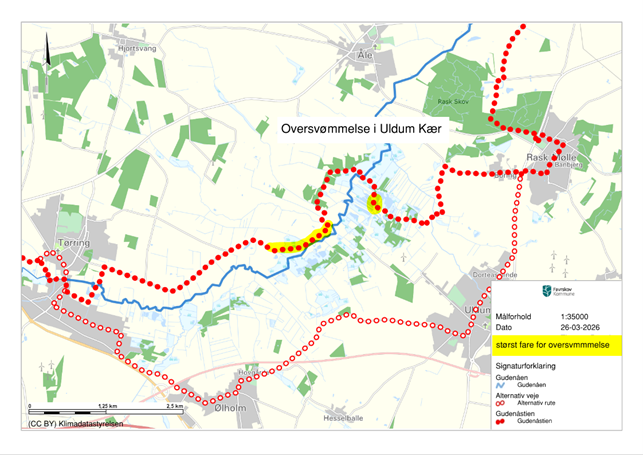
Download the flood maps as pdf for printingUldum Kær
If the central part of the pond is flooded, turn off in Tørring or Rask Mølle to go around it.
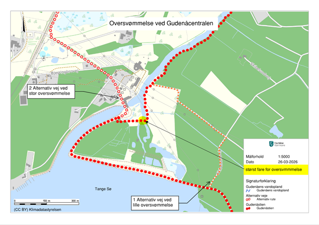
Gudenå Central's garden
Just below the control center at the crossing of Tangeværkets emergency outlet.
You must choose whether you want to turn off when you meet the road that turns off to the north approx. 700 m south of Gudenåcentralen when coming from the south. Approx. 200 before Gudenåcentralen when coming from the north.
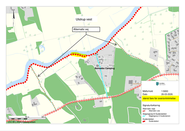
West of Ulstrup
You must choose whether to turn from 500 m before Bamsebo Camping when coming from the Bjerringbro side (west) and about 250 before Bamsebo Camping when coming from the Ulstrup side (east).
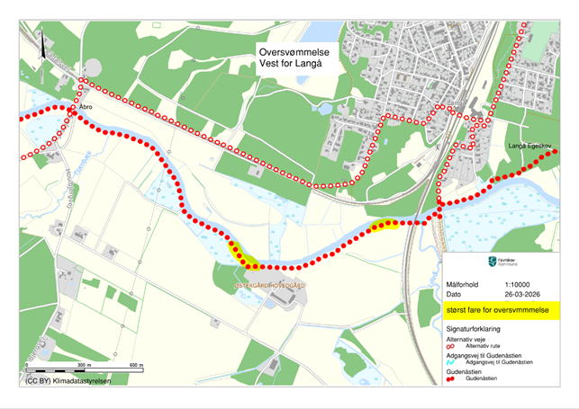
Åbro to Langå
Turn off at Åbro when coming from the west and at Den Gamle Jernbanebro when coming from the east.
Follow the gravel road that runs parallel to the track on the northern side.
How it works
Every morning at 8am, the current water level and elevation of the entire trail is used to calculate if any sections of the trail are flooded. The calculation is indicative as there are many factors that affect the navigability of the path.
The project’s model is still under development, so if you as a user encounter irregularities, please write to the GudenåSamarbejdets coordinator at gunn@favrskov.dk with a screenshot of where you are on the trail. Please send a picture and a description of the problem. We will then use it to adapt the model on an ongoing basis.
If you’re going hiking and there are alternative roads on the route you’re hiking, it’s a good idea to check the passability of the path before you set off.